Geocoding |
My current main task is to develop, manage and provide technical support for the provincial geocoding services that I've developed. These services are highly customized XML documents that are able to make use of all the NSCAF fields and not only search, but geocode addresses in the form of address validation. Python has been heavily used in the overall process and through the use of scripts and scheduled tasks, I've been able to run this process daily for updates and send out emails if anything goes wrong. Sadly it's still in development, but once it's publicly available, a link will be included.
|
|
When I started at the Nova Scotia Geomatics Centre and was given the task of being the sole collector of building footprints there was a basic workflow in place. Shortly thereafter, I began brainstorming new ways of capturing and managing the footprints to increase productivity as well as reduce input error. Not long after I was given full control of the project and commenced turning my ideas into reality. While I’d like to say that everything worked flawlessly the first time, it’s simply not true. After rigorous testing, problem-solving and analysis the tools and Python Add-ins were implemented into the workflow.
As the project moved along, I began to see ways that I could improve the existing tools and also portions of the project that would benefit from the addition of new tools. At the same time, I started documenting the new workflow I had developed. This turned into a project of its own. The result was a highly detailed Standard Operating Procedure or SOP documenting each aspect of the footprint project. Since starting this project I have collected over 130,000 footprints with a daily average of approximately 500. I attribute much of this to the tools I’ve created which can do the following and more:
|
Nova Scotia Civic Address File
|
Modeling Fales River Flood ExtentsShown below is a animation showing calculated flood extents for the Fales River subdivision, located in Greenwood Nova Scotia. ArcScene 10.1 allowed me to 'pull' features off the ground making this animation three dimensional and thus provides a more realistic view.
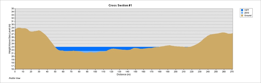
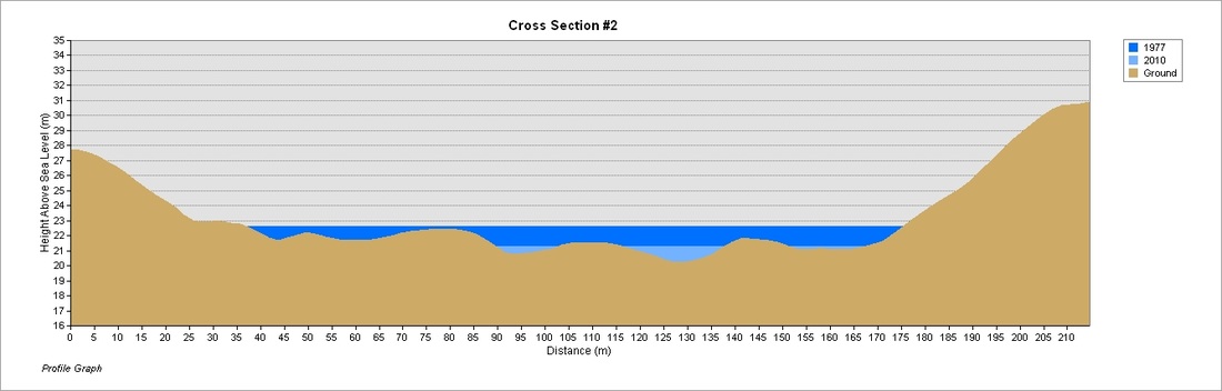
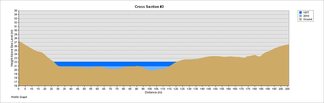
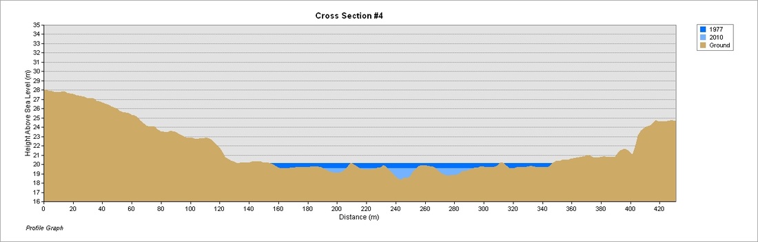
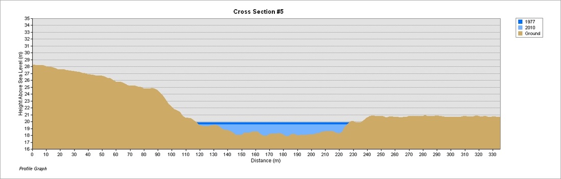
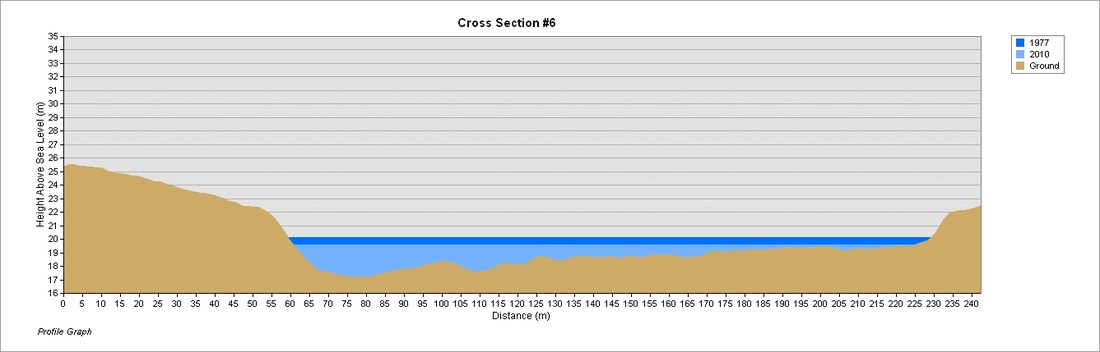
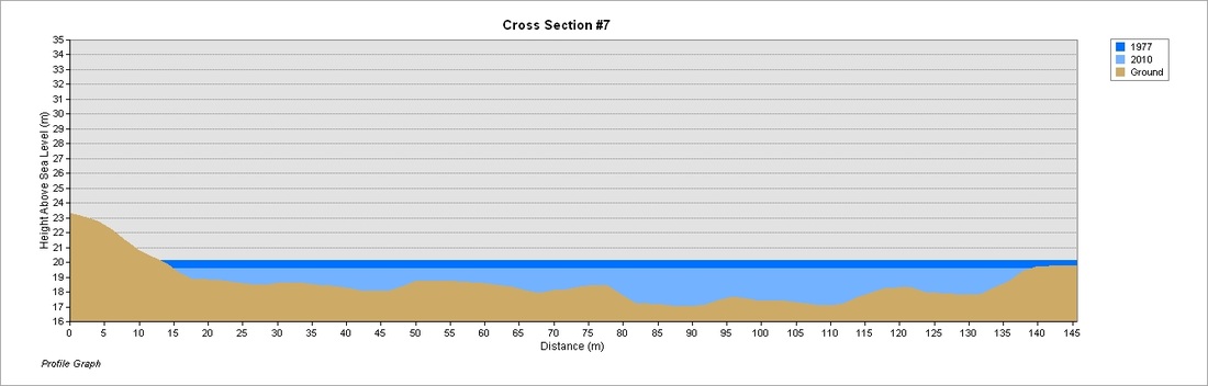
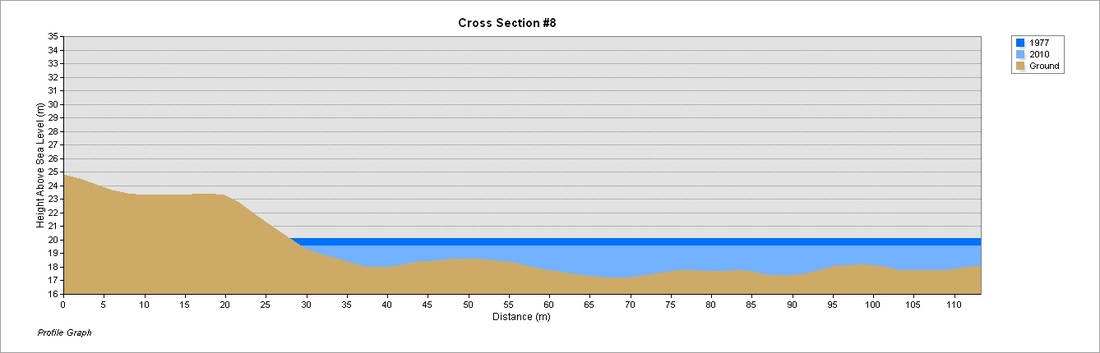
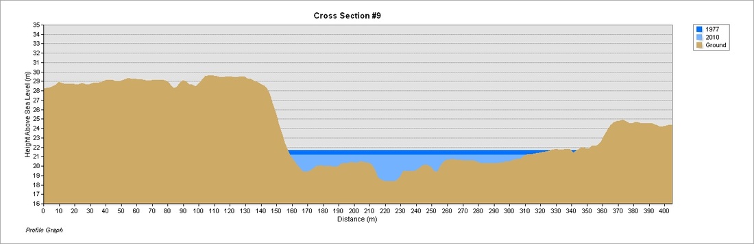
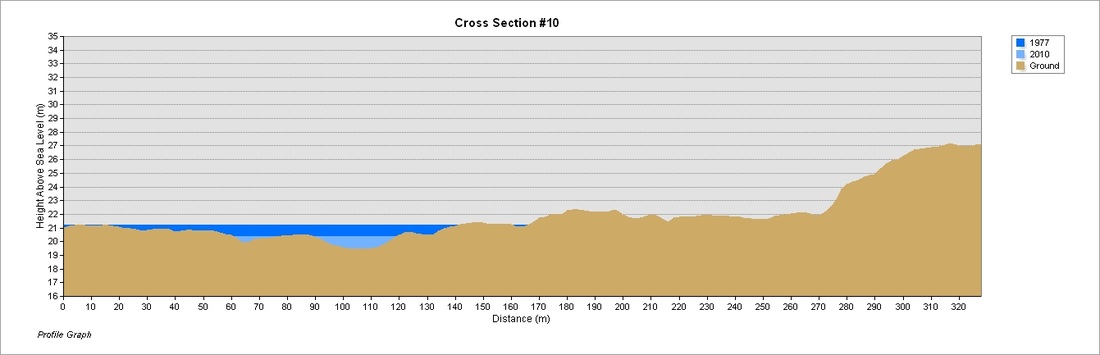
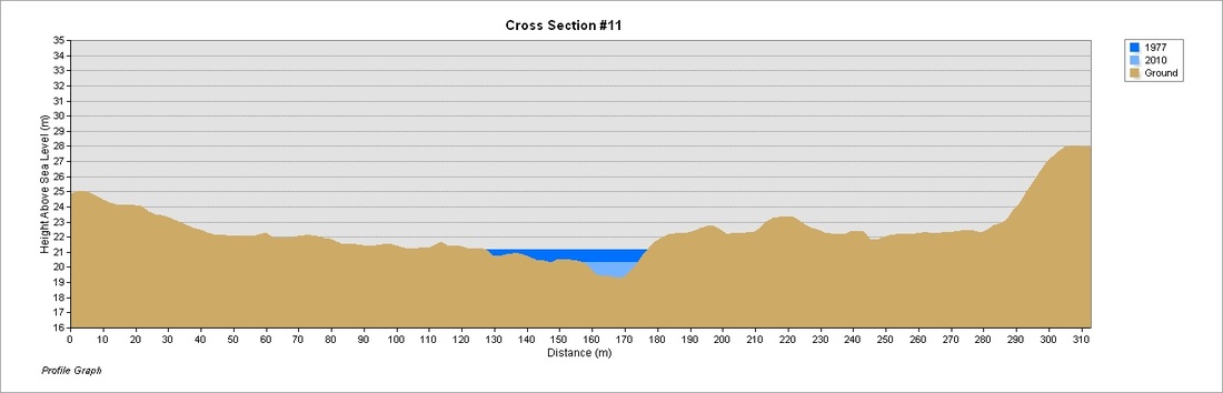
Depicted below are the 11 profile graphs used to show extents of the flooding of the two worst years (1977 & 2010). Because they are shown in context with the elevation from the study area (Fales River Subdivision, Greenwood Nova Scotia), it becomes easier to understand why certain areas flood easier than others.
|
|
Nova Scotia Topographic Database
Completed as an introduction to Project Management, this map and report are the results of extensive geoprocessing, documentation, scripting and time management. The report (available via email) details the process of selecting the data, study area and final products as well as the tasks and tools used to arrive at the final results.
Destined to replicate National Topographic Series 21A9, this map uses only Nova Scotia Topographic Database features. The symbology and layout was designed to replicate that of the NTS as closely as possible. Annotation was created using Visual Basic scripts in conjunction with Maplex to automate much of the process.
Destined to replicate National Topographic Series 21A9, this map uses only Nova Scotia Topographic Database features. The symbology and layout was designed to replicate that of the NTS as closely as possible. Annotation was created using Visual Basic scripts in conjunction with Maplex to automate much of the process.
